
Geologists in South Carolina, in partnership with S.C. Department of Natural Resources Geological Survey, the University of South Carolina and College of Charleston, have released a report on the spate of small earthquakes this year between Elgin and Lugoff.
The report was a joint effort with C. Scott Howard, state heologist, South Carolina Department of Natural Resources-Geological Survey; Steven Jaume, professor, Department of Geology and Environmental Geosciences, College of Charleston; Scott M. White, director and professor, South Carolina Seismic Network, School of Earth, Ocean and Environment, University of South Carolina; and Pradeep Talwani, professor emeritus, School of the Earth Ocean & Environment, University of South Carolina.
The report says there have been 56 earthquakes recorded between Dec. 27, 2021, and July 5, 2022, along the Interstate 20 corridor between Elgin and Lugoff. The most recent one happened July 19 with an estimated magnitude of 2.1.
The cluster of seismic events is called an earthquake swarm, groups of events located in proximity to each other in location and timing. Earthquake swarms are not uncommon in the Palmetto State. However, the latest one is unusual because of its location near Elgin.
This swarm is also unique because five of the earthquakes registered a magnitude between 3.3 and 3.6 which is higher than any previous swarm in South Carolina.
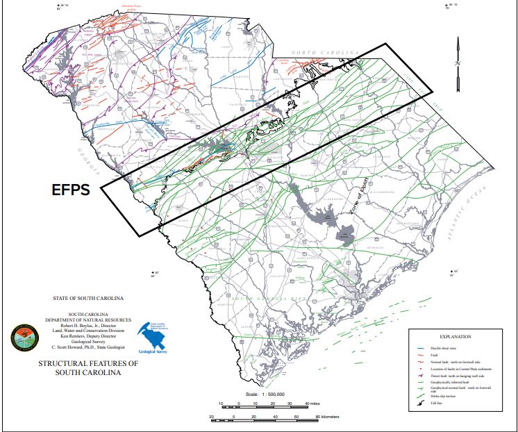
The Elgin earthquakes are occurring along the Eastern Piedmont Fault System. It runs northeast to southwest from Virginia to Georgia. The report said EPFS an ancient fault system, “formed initially as a ductile shear zone at great depth. It was exhumed during uplift and erosion of the Appalachian Mountains. Many of these ductile shears healed during this time, possibly increasing the strength of the rocks. As the EPFS uplifted, the rock behavior became brittle, and faults formed or reoccupied existing structures.”

The geologists investigated what could have triggered the earthquake swarm near Elgin. One theory is hydroseismitity, the effect water has on fault planes, is being investigated as a possible contributing factor. The report said the nearby Wateree River, fluctuating river discharges and precipitation could be involved in the seismic activity.
MORE: Rural Georgia counties pinpointed as hotspots for death from four common cancers
South Carolina has experienced a number of earthquakes over the years. One on Valentine’s Day in 2014 was centered near Edgefield and was felt in Augusta. That registered a 4.1 magnitude. There were no injuries or extensive damage, but cracks were found in some buildings on the city’s town square.
One of the largest earthquakes to hit the eastern United States happened in Charleston on Aug, 31, 1886. It happened about 9:50 p.m. and lasted less than a minute but extensively damaged the city and claimed about 60 lives.
Seismological instrumentation did not exist, so estimates of its size and location were based on the damage. SCDNR said it was estimated at a 7.6 magnitude. The force was felt over two-and-a-half million square miles (from Cuba to New York, and Bermuda to the Mississippi River).
The current report, along with more information and history about earthquakes in South Carolina, is at https://www.dnr.sc.gov/geology/earthquake-info.html

Dana Lynn McIntyre is a general assignment reporter for The Augusta Press. Reach her at dana@theaugustapress.com


